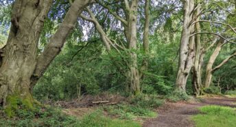
More protection for the Chilterns Beechwoods Special Area of Conservation
In a win for the environment, we are pleased that a recently published ecological report reveals that more action is needed to protect the Chilterns Beechwoods Special Area of Conservation (SAC), including the Ashridge Estate and Tring Woodlands.
The Chilterns Beechwoods SAC is under damaging pressure from increasing visitor numbers. Until satisfactory mitigation measures are in place, Dacorum Borough Council is legally required to put a temporary halt on granting any planning permissions for new homes throughout its area.
What is a Special Area of Conservation, and what are the planning implications
A large part of the Ashridge Estate in the Borough area is within the Chilterns Beechwoods SAC. Tring Woodlands are also part of the SAC. Special Area of Conservation, or SAC, is a European wildlife designation first put into effect by The Habitats Regulations (2010). Although the UK has left the European Union, the legal obligations have been incorporated into UK law. This means that SACs form the top tier of nature conservation sites nationally. There is another SAC in Hertfordshire, Wormley and Hoddesdonpark Woods in Broxbourne Borough, and there are 256 SACs throughout England.
The Habitats Regulations require that a local planning authority must take into account the potential impact of any proposals in a local plan, and any grant of planning permission, on any SAC within its area. This also applies to any other local planning authority whose local plan proposals could impact on the SAC, even if the site is not within its area.
Why is the Chilterns Beechwoods SAC important
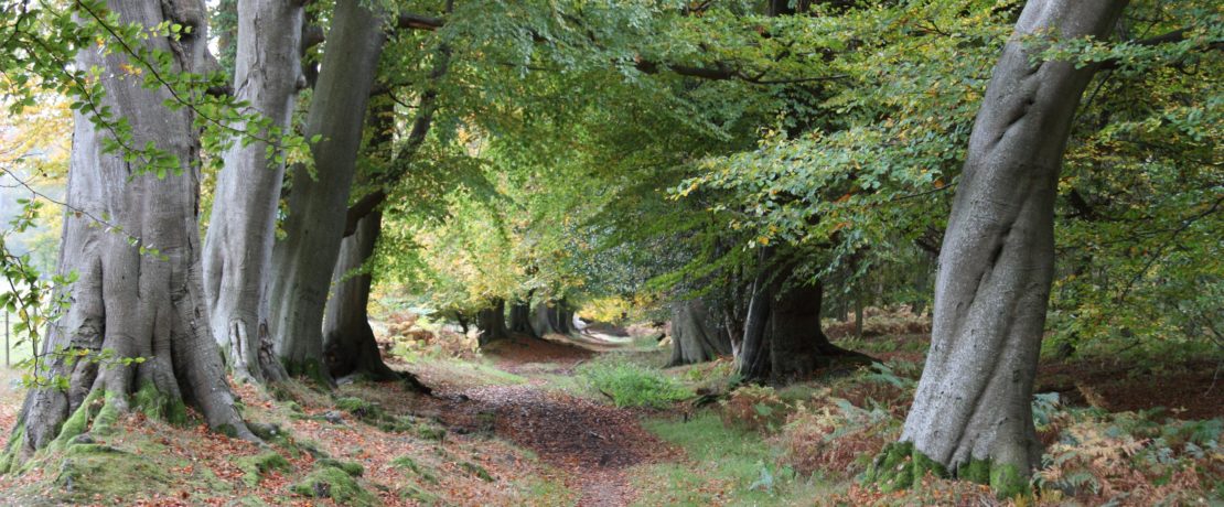
The Chilterns Beechwoods are noted for their beech-dominated woodlands, which include many ancient or veteran trees, such as those in Frithsden Beeches. They also incorporate areas of open grassland, and special conditions which support rare stag beetles. The sites contain a number of notable and rare plants.
The total area of the SAC is large, covering 1285 hectares, with separate areas further south in the Chilterns in addition to those at Ashridge and Tring.
How many people visit the Chilterns Beechwoods
The Chilterns Beechwoods, and Ashridge in particular, are under increasing pressure from visitors who live in Dacorum and the surrounding areas. It is estimated that there are 1.7 million individual visits to the Ashridge Estate every year. This is a far larger figure than the entire population of Hertfordshire. Surveys reveal that many people visit more than once a week, mostly travelling from the local area. If nothing is done new housing development will lead to further visitor pressures and damage to the special qualities of the SAC.
The Council’s announcement
In a recent statement Dacorum Borough Council said:
‘Following advice from Natural England, a mitigation strategy is now needed, which sets out the actions necessary to protect the SAC from both existing and future pressures. We are collaborating with Natural England, Hertfordshire County Council, neighbouring authorities and the National Trust, who care for Ashridge Estate, to develop an interim mitigation strategy.
As a result, the way we deal with planning applications in the future that involve new homes (and some other types of development) is going to change. Such proposals that are within 500 metres of Ashridge Estate and Tring Woodlands are likely to be refused.
In addition to this, we are legally required not to issue decisions on similar applications elsewhere in the Borough until appropriate mitigation is secured. In the interim, this will mean additional checks for affected planning applications and the need for us to put on hold issuing the final decision notice.’
Initially, the Council has been focussing on understanding the impact of recreational (visitor) pressures on the SAC, and will need to complete other assessments. Expert consultants carried out a variety of surveys of these sites during 2021. Their research has concluded that there is damage to the conservation interest of the SAC from public access and disturbance, particularly at the Ashridge Estate. It is the Council’s legal responsibility now to take steps to ensure that the protected features of the SAC are safeguarded from the additional visitor pressure generated by new development.
What sorts of damage are occurring
Damage to the qualifying features of the protected sites comes in many forms. Evidence gathered to date has identified damage to the SAC from soil compaction and root exposure, erosion of footpaths by people, horses and bikes, den building, trampling of rare plants by walkers, visitor parking, littering, fires from barbeques, vandalism, and dog fouling. Evidence gathered on-site by consultants Footprint Ecology identifies almost 500 examples of damage and other impacts to the SAC. The majority of these are at the Ashridge Estate where damage is widespread and is severe in places. There is some evidence of damage at Tring Woodlands also, including some localised damage that is severe.
The Zone of Influence
The consultants identified that the majority of visitors are coming from a 12.6 km radius of the Ashridge Estate, the busiest part of the SAC. This distance is based on the on-site postcode survey of visitors to the SAC collated during 2021. As a result a Zone of Influence with this radius, 12.6 km, has been established and it is in this area that planning applications will be affected. This area extends across all of Dacorum and into the edges of a number of adjoining authorities: St Albans City and District and Three Rivers District in Hertfordshire, and Buckinghamshire and Central Bedfordshire Councils.
What happens next
The Council is only legally able to finalise a Local Plan, or grant planning permission for development, where it can rule that there will be no significant adverse effects on the integrity of the SAC, either alone or in combination with other plans or projects.
Both on-site and off-site mitigating measures are expected to be needed to relieve visitor pressure at Ashridge. In addition, the impact on the SAC of air pollution from traffic will have to be assessed.
You can see a map of the 12.6 km Zone of Influence, and read more about the ecological report and its implications on the Council website.
We very much welcome this news and will continue to monitor the development of the mitigation strategy. Be among the first to receive updates by joining us – we are the local countryside charity for Hertfordshire.
